Dear all,
Somehow I have missed this discussion regarding Satbeams...
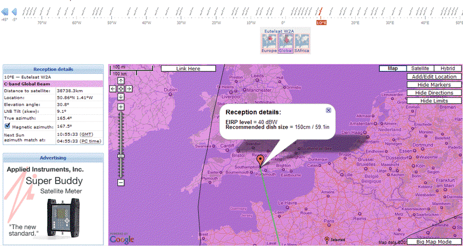
I just wanted to state that some people may not like Satbeam's interface, but it was designed this way to ensure that any map can be reached with maximum 2-3 clicks of a mouse. That's why there is always a satellites lineup on top. It takes some time to get used to navigation but I am sure at the end you will appreciate it.
")
Regarding the maps they are surely slower than regular "picture" maps but that's the cost of having them scalable and having all the math that provides the dish alignment help. The majority of the US/Canada maps are coming from the same source as here at SATMAPS - FCC and were kindly provided by our friend Nelson61! All other maps were recieved from the best possible sources including directly from the Satellite providers. The maps are regulary updated and at the moment we have the biggest collection of satellite footprints in the world in KML (Google Earth) format.
We are constantly looking at improving the site and your feedback is very important for us!
Should you have any suggestions how to improve the website or willing to help with maintaining the TPs/channels data do not hesitate to contact us through contact form at Satbeams or send me a PM here.
I have subscribed to this thread and will try to do my best to address your questions and concerns here. Just bear in mind the time difference as I am based in Europe.
Sincerely,
Alexander aka SatBeams
Alexander,
Hello! We had a conversation via email in early October of 2009. You may not remember me specificially, but you sent me a PM through the ALSAT forum and we discussed a few items regarding the SatBeams site and its navigation.
I am registered as a member of SatBeams under the same screen name as I use here on SatelliteGuys.us and on ALSAT's site (AcWxRADAR).
I used to use Lyngsat and SatCoDX for satellite beam, transponder and channel information, but since you and I conversed in October, I have been using SatBeams exclusively. I liked your maps much better then, and now that Lyngsat has changed their map format, your site has become the ultimate site for this in my opinion.
Once I honed my skills in navigating the SatBeams site, it became obvious that it is so much better than anything else available at this time and much better than the predecessors.
Certain aspects of Lyngsat's site are quicker to navigate, but then again, they don't contain as much data as SatBeams does. Lyngsat is still good as a quick reference guide, but it falls short when it comes to details.
I do still have a few issues with loading some of the data from SatBeams, though. I detect quite a few "server error" messages and sometimes, the site locks up and I have to log out and back in and start over. Some of this could be an issue with my PC and my internet connection, but I also detect this when I use other PCs and even my work PC (which is a major US Corporation - so the connection shouldn't be of poor quality).
An other issue that I discussed with you back in October still exists. This is the issue regarding selecting a specific orbital position to display EIRP maps. The site automatically loads a default satellite footprint map when there is more than one map available. I wish you could program the site to prompt the user to select the specific satellite or beam before it begins loading anything. This is especially important for people who have slow internet connections and lame PC's as it sometimes requires a bit of time to load all the map chunks. If the map that the site loads automatically is not the one you wanted, you have to wait for it to load in its entireity before switching to the beam you originally wanted to view. This isn't a terrible obstacle to overcome, but if you are in a hurry you really notice the delay that it creates.
Beyond these minor issues, I really am impressed with SatBeams. As you may have noticed, I have been promoting your site here. When something is good, I don't usually say too much about it, but when it is exceptional, I definitely make mention of it. I think that SatBeams is exceptional.
Thank you Alexander D.,
Gordy (AcWxRADAR)

 hee hee! But will take in a movie and dinner tonight in Norfolk.