
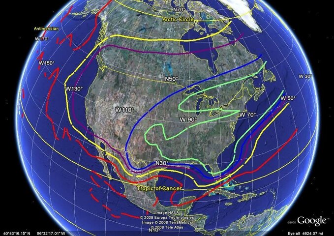
Echostar 5 is in the news both for poor reception in the NW and Echostar's recent hint to the FCC that they may request to move it 19 degrees West after Ceil 2 launches. The attached footprint gives one an idea of what's happening. It would appear that moving 19 degrees west could dramatically inprove signal strenght in the Western US if that's what they want to do. It's counter-intuitive, but the strongest signal strengths today for E5 appears to be in the Eastern US.
Green = 52.8 dBW
Blue = 50.8 dBW
Purple = 48.8 dBW
Yellow = 44.8 dBW
Red = 34.8 dBW
Green = 52.8 dBW
Blue = 50.8 dBW
Purple = 48.8 dBW
Yellow = 44.8 dBW
Red = 34.8 dBW
Attachments
Last edited:
 This coverage map is certainly not intuitive for a Sat sitting at 129W. It must be pointing at the horizon to the east to get way better signal on the east coast than in the area directly below it in longitude. No wonder folks out west complain about this baby
")
 :
: