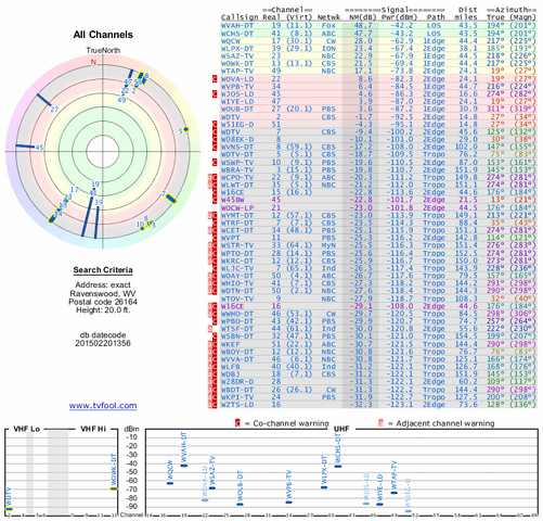
I know that terrain, trees and other obstacles can affect the receiving of the signals, but I've been tinkering with my Ariel antenna today, trying to pickup a local station to watch Mash & Andy Griffith, since none of the channels I'm getting with dish are airing those shows without changing my package.
There is a station WTAP that is 45kw and it seems to come in decent I guess, I'm about 24.2 miles from the transmitter.
This other station is 15kw and I wasn't getting any hits at all.
So my question is, Is there any way of roughly calculating the distance these powered stations can reach? Or a general rule of thumb when trying to calculate this?
")