I can't even make out the numbers

In my experience the former maps were accurate and you could at least see the letters and numbers
 , 99, 103 and 125
These beam maps are the ones published by the satellite owners.
Ex: Intelsat Global Telecommunications Satellite Network
")
These beam maps are the ones published by the satellite owners.
Ex: Intelsat Global Telecommunications Satellite Network
I've always wondered where they came from, and was dubious about their accuracy, since they didn't come from the sat owners.
John,
Try Satbeams.com instead, I think you will appreciate it once you become accustomed to the format and navigation. Their maps are "interactive" and you can zoom in/zoom out and paneast/west/north and south. You can even dial them in down to the city level and beyond. Very nice!
It is all that I use now.
RADAR
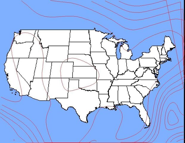
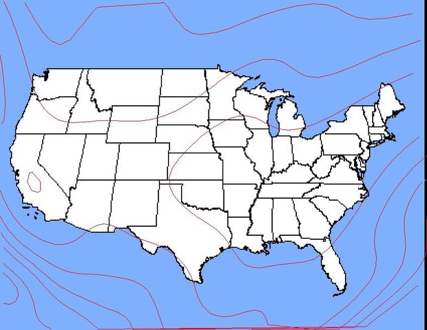
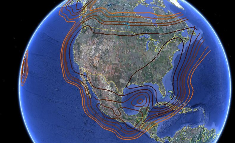
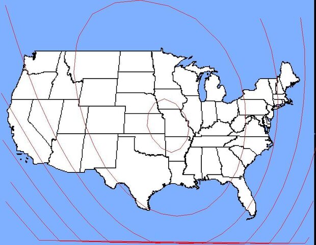
It probably came from the sat owners as they publish more data (If I remember correctly, the gain and a latitude / longitude coordinate) to the FCC database that is publicly available but very hard to find.
EDIT - About a year ago I tried to parse the FCC data and here are a few examples of what I was able to get.
I can't even make out the numbers
In my experience the former maps were accurate and you could at least see the letters and numbers
AcWxRadar-
I found using satbeams maps the other day for Europe that a good many of them that open display print so small that it can not be read. Also for many of the C-band sats they only show that there is a broadcast pattern and list no dbm at all.
For quick reference and ease of use I prefer the way Lyngsat use to display the maps. I'd like to see a poll taken to see who likes or prefers which style maps and the source providing or had provided them.