Tracking aircraft with dump1090 ADS-B Raspberry Pi

delta_charlie

SatelliteGuys Pro
Original poster
May 12, 2008
716
155
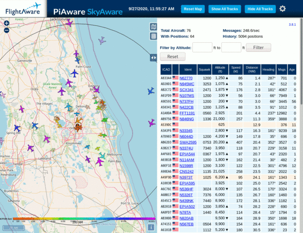
Hi all, having more fun with the little Raspberry Pi remote mounted at the discone antenna.

I live right under the approach to Orlando International Airport (MCO) and thought it would fun and interesting to see if I could get Dump1090 running on the Raspberry Pi.

Not sure I went about it in the best or fastest way but learned a lot and just got it going.

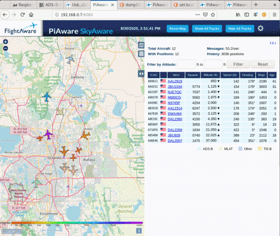
Turns out the software includes a web server that runs on the Raspberry Pi and can be accessed from the desktop by entering the ip for the Raspberry and use the default port of 8080

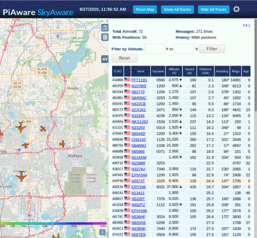
Here are some screen shots.

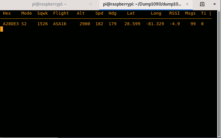
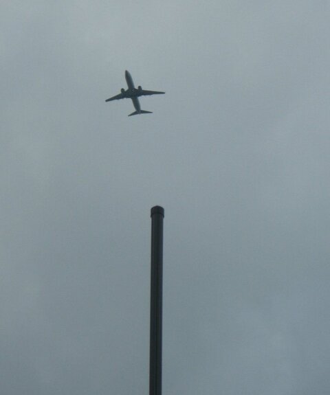
The black term shows an aircraft on short final (2900 feet up) I could hear it too :)
 

Attachments

  • BuiltInWeb2.gif
    BuiltInWeb2.gif
    219.2 KB · Views: 345
  • TermTest.gif
    TermTest.gif
    11.6 KB · Views: 255
Perhaps the best (easy) link for installing and lots more info is:

Below is what 1090 MHz looks like on GQRX.
 

Attachments

  • 1090onGQRX.gif
    1090onGQRX.gif
    168.4 KB · Views: 207
  • Like
Reactions: KE4EST
Delta Charlie, How come your PiAware is not showing distance of planes from you? Did you choose not to set location?
It does now, took a while for me to figure out how to set my location. The Flightaware control page has what looks like an edit link but only works if it is clicked on. Does nothing on rollover so I missed it.
 
I like taking binoculars and looking overhead when a c17 is directly overhead.
I'm just north of the VOR station at KORL. It marks the end of the 2500 foot minimum on the approach to KMCO so all the big planes are at 2700 > 2500 feet overhead when landing to the south. Don't need the binoculars for these ;-) The VOR is also used by aircraft in route to other locations 35,000 > 40,000 feet. Will have to give the binoculars a try for these on a clear day. Sometimes at first light in the morning the planes are up in the sun and can look stunning even with the naked eye.
 
I am midway between Charllote and Atlanta route, tons of commercial planes. But also lots of Mil-Air. I don't here mush on the scanner, but no mistaking the sound of a F-16 or other fighter jet.
 
Just checked and found it's busy here too for a Sunday.

Check out the top one on the close up screenshot. Could hear it indoors :) Not loud as it is running low throttle and noise abatement but still making wind, flaps and landing gear deployment sounds.
 

Attachments

  • SS092720a.gif
    SS092720a.gif
    185.3 KB · Views: 208
  • SS092720b.gif
    SS092720b.gif
    201 KB · Views: 214
Line of sight reception? I think this one counts ;-)

Was taken with a point and shoot under poor lighting. Want to try again with the DSLR, better lens and better lighting.
 

Attachments

  • LineOfSight.jpg
    LineOfSight.jpg
    34.3 KB · Views: 203
Cool beans, most of the interesting stuff here is to hight to see with the naked eye. Once in awhile yoy will see some KC130 tankers coming into the path fairly low.
Plus Lockheed is firing up again here in Greenville, so starting to Se more stuff.
 
  • Like
Reactions: delta_charlie
With Dump 1090, you get all the large planes but miss a lot of the general aviation planes that operate on a lower frequency. I have built several of the ADS-B receivers that cover both frequencies and have a built in GPS chip. You can build these for about $150. If you are near one of the FAA ADS-B towers, you can also receive weather radar.
 
***

Users Who Are Viewing This Thread (Total: 1, Members: 0, Guests: 1)

Who Read This Thread (Total Members: 3)

Latest posts