

Social Feed

Is it possible to set up a FTA system in an apartment? I'm not even sure i can reach a satellite from my balcony.
I haven't bought any receivers but i have a couple of analog c/ku band receivers laying around. I also have an old dishnet dish on a pole and a tripod. (yes i know i'll have to get a FTA lnb).
The balcony faces south although there's another building facing it. It's not any taller than my building, and i'm on the top floor.
So anywho,
Is it possible, and what kind of money can i expect to pay for an entry level system.
Also, I'm under the impression that I will not be able to pick up C-Band Signals with a small dish. Is that correct?
Sorry for all the dumb questions.
7 Replies
·
2493 views


 I missed that on his post, hehe.

Staff member
HERE TO HELP YOU!
Cutting Edge
Sometimes a thread gets so many posts in it that is can cause issues for the server so that why today we introduce The Song Name Game Part 3!
So let the game continue!
The last song was added by Bobby who posted...
One Meat Ball - Andrews Sisters
CONTINUE ON AND HAVE FUN! WELCOME HOME TO SATELLITEGUYS.US!
Here are the original rules for the game as posted by WebbyDude back in 2006. http://www.satelliteguys.us/threads/68645-Song-Name-Game
Just name a song title and the band who performed it. The next person does the same thing, but needs to list a song title or band name which includes a word from the previous entry. Pick songs from any genre.
Example:
Long Live Rock and Roll -- Rainbow
Rainbow in the Dark -- Dio
Another example:
Ride the Lightning -- Metallica
Lightning Strikes -- Ozzy Osbourne
Get it?
An additional note: we all know that song titles, sometimes, use profane words. Because this is a family friendly website it is advised that you clean up that title up a bit. This is accomplished by using something like sh!t instead of the real word. Thanks....
68599 Replies
·
2677478 views


Pub Member / Supporter
I set up a music server for my brother a few years ago. It's basically a small headless computer but it needs to have a DHCP IP address reserved for it in the router settings. This was easy to do in his DSL router. He's switching to Starlink now and I was wondering if these setting are easily accessible in the Starlink router. I'm pretty sure he will be getting the latest V5 router.
3 Replies
·
71 views


IS Amiko MIRA 3 any good ???
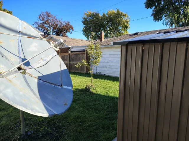
Can you recommend the best to cover all bases. NO BEEPS on certain channels 101w (NEWSMAX ,NEWS NATION), a clock that keeps working STEADY for timed recording ,solid unit with good lifespan. My Amiko died AND my Linkbox has NO Favorites Button and BEEPS on many channels. Picking up 105 west with a NEW SHED IN THE Way with 6 foot Cband ..95 percent quality ...unbelievable.
Can you recommend the best to cover all bases. NO BEEPS on certain channels 101w (NEWSMAX ,NEWS NATION), a clock that keeps working STEADY for timed recording ,solid unit with good lifespan. My Amiko died AND my Linkbox has NO Favorites Button and BEEPS on many channels. Picking up 105 west with a NEW SHED IN THE Way with 6 foot Cband ..95 percent quality ...unbelievable.
9 Replies
·
123 views


Pub Member / Supporter
Lifetime Supporter
Didn't see a thread like this so I figured why not start one. This is about natural supplements. If you aren't into supplements, fine, but please let those of us who do want to discuss this discuss it.
The first one I wanted to mention has been a real life changer. I'm 62 and still do all of my own install work at my business....also do all the yard work at the house. A few years ago I started noticing that I was losing my range of movement, it was even getting hard to bend over and lace up my boots. Almost got stuck in an attic because I couldn't get turned around once the work was done. Didn't think much of it and figured with age comes stiffness that was only going to get worse as time went on.
It was then that I stumbled across a video which was discussing rotator cuff tears and why they were to prevalent these days. Turns out, the culprit is a simple deficiency in MANGANESE which is key in keeping your tendons flexible. Most anti-biotics strip your body of any manganese it might have had which is why certain anti-biotics, especially those in the Cipro family. I actually knew a man who had two tendons tear while on that stuff.
Went to Amazon and ordered some manganese. Now it took a while, it wasn't instant, but gradually I have regained all of my flexibility. I can bend over and touch my toes while standing with no pain and putting on my boots is no longer a chore.
Pretty cheap too. The bottle I ordered was a 200 ct for under $13. They said to take double the normal dose for the first month because most people are severely lacking, then go to one a day.
7 Replies
·
83 views

Pub Member / Supporter
Lifetime Supporter
Can't help but wonder if a worker overlooked checking the harness. I rarely ride a roller coaster anymore but when I do I check the harness myself pretty aggressively.
Can't imagine what the son is going through.

 www.dailymail.com
Can't imagine what the son is going through.
Dad levitated and bled then fell to his death from coaster
Eyewitnesses have shared fresh details of the horrific accident that happened at Six Flags Over Georgia on Monday afternoon.
28 Replies
·
405 views

Season 2 order already in hand:
'Star Trek: Starfleet Academy' Renewed for Season 2, Tatiana Maslany to Guest Star in Season 1
I've not been optimistic about this show based on what I've read so far. Seems to be aimed at a younger audience. Interesting though that Tatiana Maslany will have some sort of role.
'Star Trek: Starfleet Academy' Renewed for Season 2, Tatiana Maslany to Guest Star in Season 1
I've not been optimistic about this show based on what I've read so far. Seems to be aimed at a younger audience. Interesting though that Tatiana Maslany will have some sort of role.
88 Replies
·
3590 views


Pub Member / Supporter
Lifetime Supporter
0 Replies
·
20 views
Pub Member / Supporter
Lifetime Supporter
I'm surprised Walmart hasn't banned this guy from all of their stores. He has been on their CASE the past few months.
View: https://www.youtube.com/shorts/f3zr37ekgKM?feature=share
View: https://www.youtube.com/shorts/f3zr37ekgKM?feature=share
77 Replies
·
773 views


Pub Member / Supporter
Lifetime Supporter
Love this guy's channel. Looks like Walmart has thrown in the towel when it comes to conventional car batteries.
I bought a new AGM battery from Walmart about a year ago, it is already needing replacing. I thought about just buying a regular battery but from what I've read, that might not be a smart move. Might check my Forscan program and see if I can change the battery type from AGM.
View: https://www.youtube.com/watch?v=awe7kY5nvdU
0 Replies
·
26 views
TWiT Tech Podcast Network
Time for another AWESOME video from the TWIT Network!
View: https://www.youtube.com/shorts/5-kh3ZIy2yc
Direct YouTube Link - Larry Ellison's Debt-Fueled Media Bet: Could It Spark a Crash? #shorts
TWIT's Website
TWIT Live Feed
View: https://www.youtube.com/shorts/5-kh3ZIy2yc
Direct YouTube Link - Larry Ellison's Debt-Fueled Media Bet: Could It Spark a Crash? #shorts
TWIT's Website
TWIT Live Feed
0 Replies
·
21 views