

Social Feed
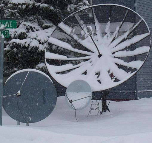
I picked up a GSP 90cm to try to get 30ºw with an elevation of 14º where I live.
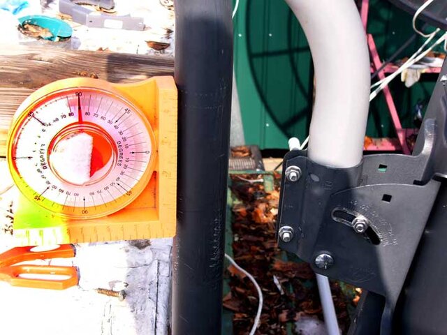
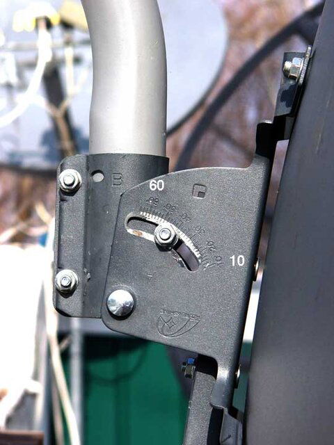
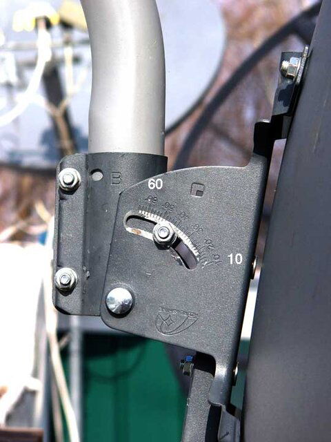
I followed the instructions to reverse the elevation bracket so it will read 0º-20º
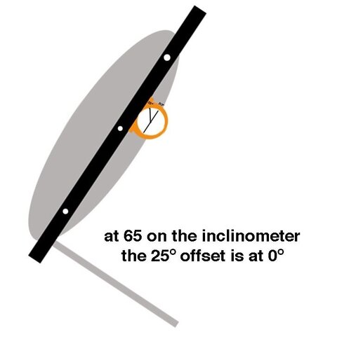
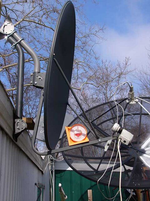
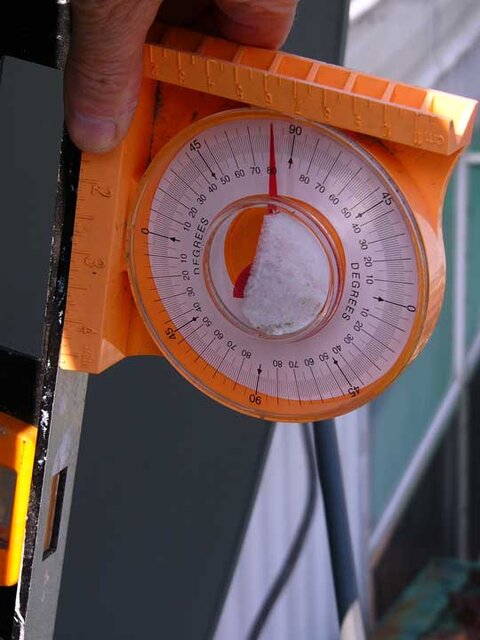
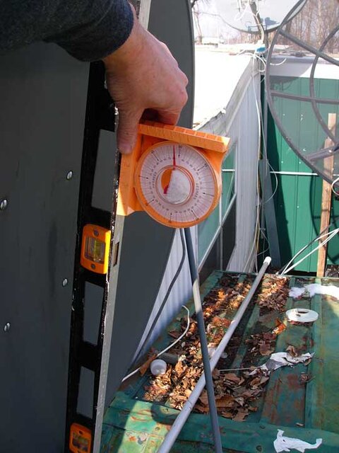
Question: What marks do I use? The manuals I've read say there is no way to use an inclinometer to set this dish, but I dumb and can't figure which pointer to use.
Since pointer 'A' goes to 65, upside down is that 0? And so would 50 be 15 ?
Thanks
http://www.satelliteguys.us/fta-manuals/189795-geosatpro-90cm-offset-dish.html
see 'Z' special elevation
6 Replies
·
2079 views








Staff member
HERE TO HELP YOU!
Cutting Edge
Sometimes a thread gets so many posts in it that is can cause issues for the server so that why today we introduce The Song Name Game Part 3!
So let the game continue!
The last song was added by Bobby who posted...
One Meat Ball - Andrews Sisters
CONTINUE ON AND HAVE FUN! WELCOME HOME TO SATELLITEGUYS.US!
Here are the original rules for the game as posted by WebbyDude back in 2006. http://www.satelliteguys.us/threads/68645-Song-Name-Game
Just name a song title and the band who performed it. The next person does the same thing, but needs to list a song title or band name which includes a word from the previous entry. Pick songs from any genre.
Example:
Long Live Rock and Roll -- Rainbow
Rainbow in the Dark -- Dio
Another example:
Ride the Lightning -- Metallica
Lightning Strikes -- Ozzy Osbourne
Get it?
An additional note: we all know that song titles, sometimes, use profane words. Because this is a family friendly website it is advised that you clean up that title up a bit. This is accomplished by using something like sh!t instead of the real word. Thanks....
68625 Replies
·
2678587 views


TWiT Tech Podcast Network
Time for another AWESOME video from the TWIT Network!
View: https://www.youtube.com/watch?v=omPQDqqbatQ
Direct YouTube Link - Whiskey Pick: Frey Ranch Straight Bourbon
TWIT's Website
TWIT Live Feed
View: https://www.youtube.com/watch?v=omPQDqqbatQ
Direct YouTube Link - Whiskey Pick: Frey Ranch Straight Bourbon
TWIT's Website
TWIT Live Feed
0 Replies
·
12 views

Lifetime Supporter
I know HipKat said that they were working on conversions but we got the official news yesterday right from Dish that starting next month all DMA's will be on the western arc, and all customers will be assigned to that. That's gonna mean a lot of customers around here aren't gonna get Dish unless there are exceptions. Too many mountains and trees.
171 Replies
·
4781 views


Pub Member / Supporter
Lifetime Supporter
1 Replies
·
25 views
Pub Member / Supporter
Lifetime Supporter
This video was put up shortly after I was able to take my family out to Yosemite in 2011. No AI.
View: https://www.youtube.com/watch?v=N6-2fVsFV8E
View: https://www.youtube.com/watch?v=N6-2fVsFV8E
0 Replies
·
14 views
Pub Member / Supporter
Lifetime Supporter
Love this guy's channel. Looks like Walmart has thrown in the towel when it comes to conventional car batteries.
I bought a new AGM battery from Walmart about a year ago, it is already needing replacing. I thought about just buying a regular battery but from what I've read, that might not be a smart move. Might check my Forscan program and see if I can change the battery type from AGM.
View: https://www.youtube.com/watch?v=awe7kY5nvdU
18 Replies
·
201 views


Supporting Founder
Really excited for this season with Kentucky having a new coach and some really exciting recruits. Probably won't last long, but here's hoping this season is great.
168 Replies
·
2403 views


Pub Member / Supporter
Lifetime Supporter
0 Replies
·
33 views

Pub Member / Supporter

Walter Koenig, Chekov on Original ‘Star Trek,’ Dies at 90
Walter Koenig, who memorably played Chekov in the original "Star Trek" series and seven "Star Trek" feature films, died Sunday in Los Angeles.
 variety.com
4 Replies
·
72 views


TWiT Tech Podcast Network
Time for another AWESOME video from the TWIT Network!
View: https://www.youtube.com/shorts/SqPMCS9OOSY
Direct YouTube Link - Preorders Open for the Brax Wink De-Googled Phone #shorts
TWIT's Website
TWIT Live Feed
View: https://www.youtube.com/shorts/SqPMCS9OOSY
Direct YouTube Link - Preorders Open for the Brax Wink De-Googled Phone #shorts
TWIT's Website
TWIT Live Feed
0 Replies
·
31 views