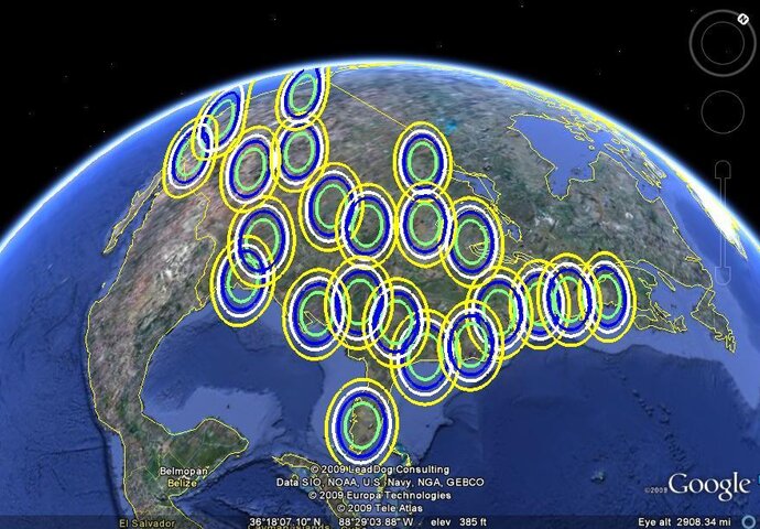
Echostar 12 61.5W Spot Beams

nelson61

SatelliteGuys Master
Original poster
Lifetime Supporter
Dec 8, 2007
8,543
8,481
Where it's Warm
Done!

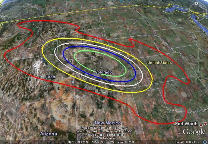
Some interesting things to see. If you really need to get some of these markets and have the money, a big dish will work wonders all the way out to the red zone.

Detailed footprints are available for any area.

I am attaching thumnails of a large area Western spot and a national map of the 50 dBw contours (standard antenna).
 

Attachments

  • Echostar 12 61.5W Spots.jpg
    Echostar 12 61.5W Spots.jpg
    116.5 KB · Views: 1,277
  • Echostar 12 61.5W E18 Denver.jpg
    Echostar 12 61.5W E18 Denver.jpg
    125.6 KB · Views: 781
Done!

Some interesting things to see. If you really need to get some of these markets and have the money, a big dish will work wonders all the way out to the red zone.

Detailed footprints are available for any area.


I am attaching thumnails of a large area Western spot and a national map of the 50 dBw contours (standard antenna).

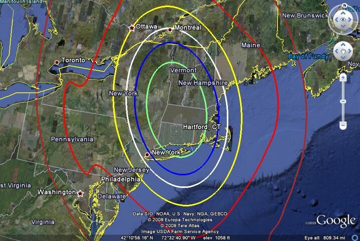
Cool. Great job! Where can I look at the spot that covers Hartford, Ct. Thanks.
 
I've done two of them...

Scranton, PA beam and the New Orleans, LA beam. All of the locals aren't mapped on the Scranton page yet, as I'm still figuring out which TID goes where. Can't see how their number scheme corresponds to a beam so I'm having to guess by DMA area.

Scranton:
SatelliteGuys.US - Subscription 61.5°W

New Orleans:
SatelliteGuys.US - Subscription 61.5°W

I'll definitely need some help from the 61.5 guys to actually see what beams are what as I know the power varies by beam a good bit.

Interesting. Assuming the read line is thee boundary of being receivable, it would seem like Clinton County might be the only real problem. I gather it's not. Wonder if the beam is not performing to spec.

Interesting, too, that Pensacola doesn't have problems.
 
Thanks. Now, what size dish for a location in between yellow and red?

It's hard to know unless you live in the area and get some present day reading for reference. This satellite is getting long in the tooth and has had some failures so the power levels they are using may be lower than design. The one thing that does not change is the shape of the beams(but it may get smaller). Back when they started, a 1.5 meter antenna would cover the red.
 
Last edited:
Interesting. Assuming the read line is thee boundary of being receivable, it would seem like Clinton County might be the only real problem. I gather it's not. Wonder if the beam is not performing to spec.

Interesting, too, that Pensacola doesn't have problems.

I can explain that one about Pensacola. On that beam is Jackson, MS and Mobile, AL(Pensacola), I receive a much higher signal from the transponder that contains Mobile than Jackson. So they have the Mobile, AL transponder cranked up a little more than the Jackson TP so they can cover that area.

These maps are all approximate so things can vary.
 
I put a few more beam maps up and mapped their locals to them.

I'm trying to figure out a few markets but the satellite beam transponder map is not matching the market location and the transponder they are currently on. I suspect Dish did some trickery with the beams since they are not utilizing the beams 100% since they do not have enough uplink centers dedicated to 61.5.
 

Users Who Are Viewing This Thread (Total: 0, Members: 0, Guests: 0)

Who Read This Thread (Total Members: 2)

Top