Dish elevation

Status
Please reply by conversation.

glen4cindy

SatelliteGuys Pro
Original poster
Sep 14, 2004
641
38
St. Louis MO, area
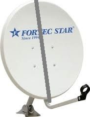
Is there a place anywhere on the dish I can put my inclinometer to verify the dish elevation?

I've read that the scale on the dish is largely inaccurate.

I've swept the sky, adjusted a bit, swept again, but nothing.

I'm trying for a single sat, no motor, and verified a active transponder.

Thanks
 
What brand and model of dish?

Each dish has a specific offset angle. If you know the offset angle specification place a straight edge on the vertical plane of the reflector (edge to edge / top to bottom) and place an angle finder on the straight edge.

To determine the dish elevation angle, take the angle finder reading and add the offset angle. Example for a 24.6 offset dish: if the dish face is straight up/down (0 degrees) add the offset angle (+24.6). The dish elevation angle is set to 24.6 degrees.

This only is accurate if the feed support arm is not bent or the LNBF clamp is the original at the feedhorn opening set that the correct OEM height.
 
If you check your right azimuth first, then you only have to test to find the right elevation. That makes it a lot easier.

You can find the right azimuth with help of the sun:
Go to http://www.satellite-calculations.com/Satellite/lookangles.htm;
Enter the right Site Latitude and Site Longitude;
Enter the wanted Satellite Position;
Enter the Date for Time Calculation;
Then click on button Calculate times for one Year.
(NB All other fields are not particularly relevant; I always leave them as they are...)

Results are given in a new webpage.

If the sun is shining on the day you have chosen, you can fabricate some tape from the top of the LNB to the top middle of your dish.
At the exact time from the above calculation, the shadow of the tape should be exactly in the middle of your dish and LNB-arm.
If not, you should at that precise moment adjust the azimuth of your dish.

When you have thus adjusted your azimuth, finding the right elevation should be a lot easier. Good luck! :)

Greetz,
A33
 
  • Like
Reactions: polgyver
I know my mast is plumb. This is a temporary location until I get my new motor installed back at my permanent location. The mast is in a bucket of concrete, and I've checked all sides with the dish mounted for level and plumb.

I've used a compass plus my memory of about where the dish pointed when it was pointed at Galaxy 19, 97 W. My azimuth should be about 190/191 and I've used a compass to get as close as I can to this. I've swept back and forth over and over, using different transponders which should be active; 11836, 11842, 11867, 12115.

I've tried 2 different LNB's. A Standard using LO of 10750 and a Universal using LO of 9750/10600.

All this leads me to believe the elevation is off. I've raised it and lowered it around 44 degrees but still have not found G19.

The dish says Fortec Star on it, but, I'm not sure what the offset angle is. It's not bent, nor is the LNB arm bent. I have the LNB twisted slightly to the left because the skew of G19 for my location shows 8.5. Would I not see anything at all if the skew was off a little?

Thanks for all these tips so far.
 
Using Titanium's offset info:
80cm = 22 degrees elevation for St. Louis
90 & 120cm = 20 degrees elevation for St. Louis

To measure the dish angle, I place an aluminum bar across the front of the dish with the Inclinometer sitting on the aluminum bar. You could use just about anything that is long enough and straight to span the front of the dish. Here's a crude illustration of what I'm trying to explain:
foretec_zpsr4ccvdik.jpg


After the elevation is set, try this if your dish is close enough to the house. Program in RT Today at 12152/H/20000 and crank up the audio to max. Go outside and move the dish azimuth. RT should come booming in! Or set your home phone near the TV and listen on a cell phone. Quick way to get one satellite aligned.
 
Last edited:
  • Like
Reactions: polgyver
'Sweeping' may not allow time enough for the receiver to lock the signal, then produced output. (Audio, video, or a Q reading.
May be faster by slowing down the sweep to small adjustments, then waiting a few seconds, and repeat.
 
  • Like
Reactions: beavs2112
Using Titanium's offset info:
80cm = 22 degrees elevation for St. Louis
90 & 120cm = 20 degrees elevation for St. Louis

To measure the dish angle, I place an aluminum bar across the front of the dish with the Inclinometer sitting on the aluminum bar. You could use just about anything that is long enough and straight to span the front of the dish. Here's a crude illustration of what I'm trying to explain:
foretec_zpsr4ccvdik.jpg


After the elevation is set, try this if your dish is close enough to the house. Program in RT Today at 12152/H/20000 and crank up the audio to max. Go outside and move the dish azimuth. RT should come booming in! Or set your home phone near the TV and listen on a cell phone. Quick way to get one satellite aligned.

The way I've been going about this is thru the Dish Setup menu, and setting the Satellite, LO frequency, and the Transponder frequency, then slowly moving the dish, waiting a second or two, moving it again, waiting a second, etc.

It does not give me an option to put in H or V and a symbol rate. It seems like before with the other receiver I found the bird the same way and then did a scan, but, it's been a long time.
 
other receiver
Is that one available? Is it 'working'? Thinking if it's got valid transponders* in it, which is necessary to 'find' a satellite, use it to tune the dish. Then replace with the one that doesn't and do a blind scan.
*frequency/polarity/SR
Don't have any experience with that rcvr but there's got to be a way to put in a valid transponder.
 
The way I've been going about this is thru the Dish Setup menu, and setting the Satellite, LO frequency, and the Transponder frequency, then slowly moving the dish, waiting a second or two, moving it again, waiting a second, etc.

It does not give me an option to put in H or V and a symbol rate. It seems like before with the other receiver I found the bird the same way and then did a scan, but, it's been a long time.
I just found this old thread that Iceberg started ( http://www.satelliteguys.us/xen/threads/visionsat-iv200-pvr-plus.101350/ ). It is about the Visionsat IV-200 PVR Plus. Take a look at his thread, he has quite a few shots of the receiver's screens posted. Don't know if yours is the plus model or not but regardless there should be screens similar to 000_1068 and 000_0189 which show the ability to change settings for symbol rate, polarity, etc. Hope it helps. :)
 
80cm = 22 degrees elevation for St. Louis

To measure the dish angle, I place an aluminum bar across the front of the dish with the Inclinometer sitting on the aluminum bar. You could use just about anything that is long enough and straight to span the front of the dish. Here's a crude illustration of what I'm trying to explain:

Last night (storms tonight, not able to test) I did exactly this. Measured exactly 22 degrees with an inclinometer. If my understanding is correct, due to the 22.75 offset of my dish, it is actually "pointing" that much higher in the sky than the dish looks like it is, hence adding 22 degrees to the offset gives the true elevation of 44.6 or it would be .75 I guess.

I've used an app for my iPhone that shows me the position of the satellites, and it appears there is nothing LOS wise that would be keeping me from seeing the satellite.

I have the bucket mount on the edge of my patio and my 1 story house is about 30 feet away. The dish should be looking over the top of the house by quite a bit.

I'm still not getting a signal but. I don't have another receiver to test with.

I do not suppose there would be any hope of connecting this to my DirecTv system just to see if the receiver is functioning? It's a SWiM system so I'd have no idea what the switch settings would be. This would be just to see if the receiver is working properly.

Thanks again.
 
Well, storms are over, and I finally locked 97W!!

During the last exercise, once I had my elevation set at 22 degrees, I began again. I was about to give up and start again, when all of the sudden, 70% quality popped in!

I might have locked sooner, but, it seems I was not going far enough east. All my nice iPhone/iPad apps kept showing the satellite in a different position.

Now, once I moved inside, it looks like I lost everything, so, tomorrow, I'm going to replace the connectors on my coax. Then I'll be able to do my scan.
 
  • Like
Reactions: Jason S and FTA4PA
I knew that: Nothing beats the sun in precision. :)
Not even an iPad.

So for checking the azimuth: I always use the sun. . . .:amen

Greetz, A33

The sun would have been a cool tool. Only I have been doing most of my "hunting" after work when I get home after 4:30 in the evening. :)
 
So, more issues. Even with my quality at 80% on 12152/H/20000, my receiver didn't scan any channels on this transponder.

I even checked several transponders from TheList, making sure the symbol rates were correct, and I got quality on some but not others.

Would there still be an alignment problem if I was peaked so well on that one transponder and can't lock others or do I need to look at cable/connectors/LNB?

I did a Blind Scan, and only found something called:

MS20 3001 11936 V 20000 which looks like a beach scene.....SID 20 TSID 10
MS10 3002 11936 V 20000 which looks like a beach scene too SID 10 TSID 10

It also found 8 radio channels. That's all.

Something can't be right here. :(
Those are the pier cams at Huntington Beach so you are pointed at 103w. Dish needs to move east a bit. Mark your elevation, azimuth on pole/mount before moving so you can return there if you need to.
 
Status
Please reply by conversation.

Users Who Are Viewing This Thread (Total: 0, Members: 0, Guests: 0)

Who Read This Thread (Total Members: 2)