General FTA question?

  • WELCOME TO THE NEW SERVER!

    If you are seeing this you are on our new server WELCOME HOME!

    While the new server is online Scott is still working on the backend including the cachine. But the site is usable while the work is being completes!

    Thank you for your patience and again WELCOME HOME!

    CLICK THE X IN THE TOP RIGHT CORNER OF THE BOX TO DISMISS THIS MESSAGE
Status
Please reply by conversation.
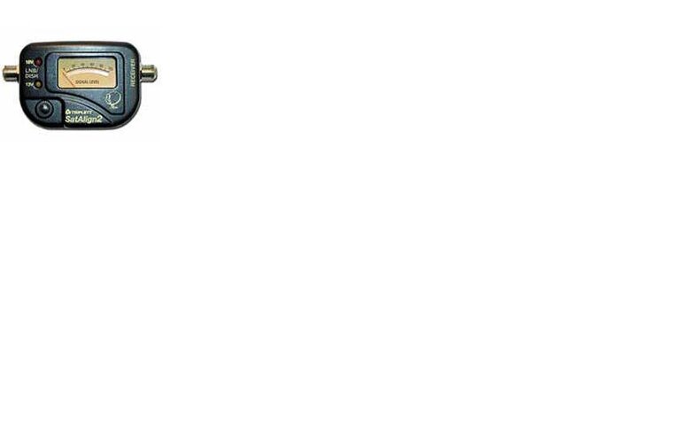
I want to learn how to use a satellite signal meter. I have a triplett satalign2. The meter has 0 to 100. 2 LED, red for 18V and Amber 13V. I turned the knob to low. Picture of the meter attached with this post.

Here is what I am doing.

1) Attach the signal meter as required
2) Turn on the Satellite receiver
3) Amber light turns on
4) Leave the needle at zero and fix my elevation to 51.7
5) Needle does not move

observation - If I move the elevation past 60 the needle moves between 80 - 100.

The red led does not light up unless I turn the satellite on and do blind scan for all H polarity.

How do I use the sat signal meter? Thank you for your reply.
 

Attachments

  • triplett.JPG
    triplett.JPG
    7 KB · Views: 125
I'll repeat myself on the satmeter

That satalign meter will help you with the initial aiming part.

Turn the knob 'til the meter squeals incessantly, even if you put your hand in front of the LNB (between the LNB and the Dish).
On my SF95c+, I have to turn the knob clockwise.
Now turn the knob back counter-clockwise 'til it's quiet again.

Now when it squeals as you're moving the dish about, you'll be on -a- satellite.
A satellite, not necessarily the satellite we want.
We confirm that your on the right satellite by watching the Quality bar on your satellite receiver using an active transponder.

For 97W I use 11789MHz V SymbolRate:28125 for aiming.
 
Finally I feel like the dog that chased the pickup and jumped on board. LOL. I was able to get some FTA channels on 97W. I do have an interesting observation.

1) The elevation reading from the sat finder was 51.7 but I had to move the elevation on fortec to past 70. Is this normal? Why is there so much discrepancies?

Now I need to try other satellite in the sky. Thank you everyone for your quick reply and valuable information.
 
observation:

On the setup menu of the sonic view. Is this value I put in?
...
LNB Power - off
Transponder - 11713
....
Sorry, I didn't read through the entire thread...
... and if you are getting the external meter to light up, you must at some time have LNB Power set to ON.
That would be necessary for most all simple setups like this.
No LNB power = no signal.

... and I'm sure someone must have mentioned to use a live transponder,
one with a strong signal.
See our own TheList for recommendations for each satellite.
 
1) The elevation reading from the sat finder was 51.7 but I had to move the elevation on fortec to past 70. Is this normal? Why is there so much discrepancies?

It is somewhat normal for the stamped elevation gauges on the dish mount to be inaccurate, but I've never heard of one being off by nearly 20 degrees. You are possibly looking at the wrong reference point. It is usually not where the bolt is (on some dishes it is), but rather the straight edge above it. It IS normal for these elevation scales to be off by as many as 5-10 degrees. Once you get a feel for aiming the dish, you never even need to look at the elevation gauge, except maybe to get the aim in the ballpark.
 
WSIATLANTA

What an ingenious and very awesome animated display you posted for dish alignment and LNBF alignment axis! I really like it very much! What program did you use to create those images?

Very well done!

RADAR

Used a combination of Photoshop to crop the pictures and Banner Maker Pro to animate them.
 
Status
Please reply by conversation.

Users Who Are Viewing This Thread (Total: 0, Members: 0, Guests: 0)

Who Read This Thread (Total Members: 1)

Latest posts