Tate if someone moves to my area, can I just recommision the modem to their new location without having to notify hughes?
Also, I assume you just guess on the postitioning of the squinter on the raven dish for azimuth settings?
PM me your email address and I can send you a PDF on exactly how to do it. Or if you have access to vanative you can find it there. These are the steps in short. From FSB_080721-01A - Moving or Swapping a HN9xxx IDU.
"This Field Service Bulletin (FSB) describes how to move or swap and HN9X00 IDU (ST)
after it has been activated.
To move an HN9X00:
Complete the following process to move just an existing (activated) indoor unit (IDU).
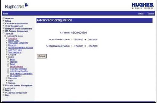
1. Call TAG at xxx-xxx-xxxx. They will need the ST Name/SAN.
2. TAG will need to 'Enable' the 'Re-Location Status' function in DSS.
3. The unit can now be moved and installed at new location, using the same SAN & PIN
4. Once installed at the new location, you must perform the antenna pointing process using the new locations
parameters, based on the new GPS co-ordinates.
5. Once the parameters have been entered, repoint the antenna, and re-register the IDU.
To swap an HN9X00 with another unit:
If it has been determined that only the current IDU needs to be replaced, the following must be completed:
1. Call TAG at xxx-xxx-xxxx. They will need the ST Name/SAN.
2. TAG will need to 'Enable' the 'Replacement Status' function in DSS.
3. Install the new IDU.
4. Type 169.254.0.1 (Factory Default IP address) in the browser to access the SCC home page."
Also this is from: HNTR0083 HN9X00 Installation and Commissioning
Module 5: Troubleshooting
"If the antenna is installed less than 500 feet from where the original unit was installed, use the same GPS parameters and re-point the antenna. Re- registration is not required, and probing is completed by the system automatically.
Probing is similar in purpose to the ranging function in Ku-band antenna installations
Probing is used to determine the required timing and power offsets from nominal values, the terminal has to apply for optimal operation
If the antenna is installed more than 500 feet from where the original unit was installed, enter new GPS parameters and use those to repoint the antenna. Re-registration is required, and probing is completed by the system automatically. During the re-registration process, the HN9X00 should retain information previously obtained by probing."
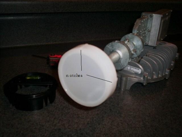
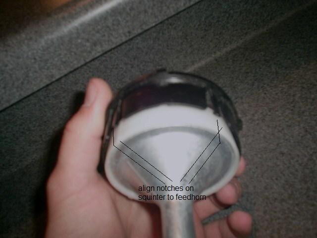
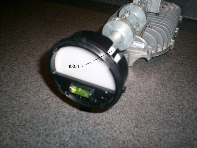
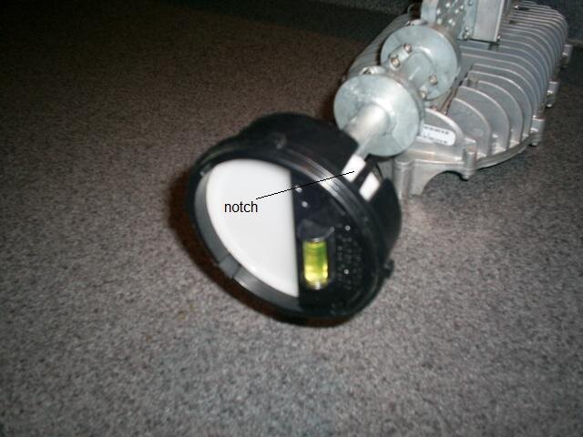
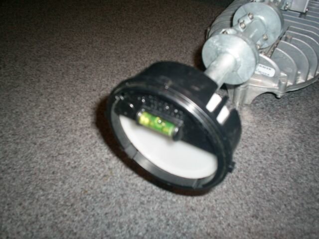
As far as the Raven squinter. If you look on the feedhorn of the Raven you will see 4 notches. These notches will align with the notches on the squinter. If you leave the mormon clamp loose enough to rotate the feedhorn you can rotate it so the notches on the feedhorn and the squinter are align and the level on the squinter is horizontal on the bottom. When this is level you can then tighten the mormon clamp and rotate the squinter 90 degrees so the notches will align and this gives you the same position as the Prodelin.

 :
: