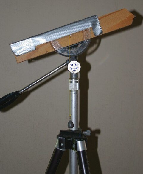
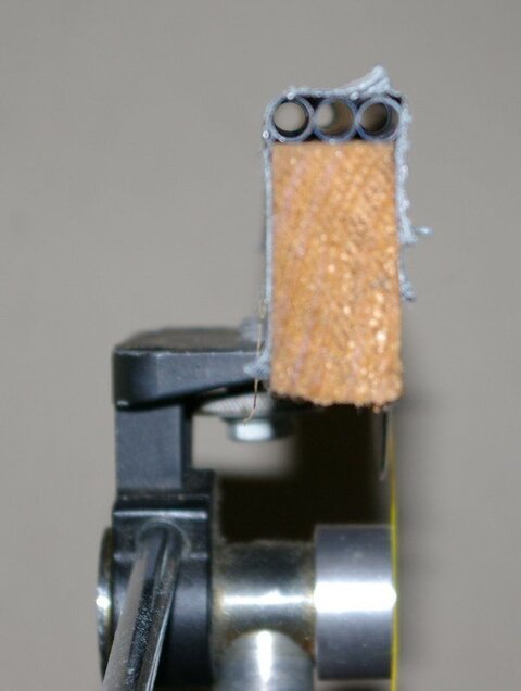
Trying to decide where to install a satellite dish, if I stick with my Winegard DS 3100
I have a spot that has a completely unobstructed view of the south, but if I want to go with
something bigger it gets harder.
I am at Latitude: 42.2603° Longitude: -85.5591°; my true south satellite is 85, viewing these photos
south is straight ahead the house and garage face east/west.
The peak of the garage is 50 feet from the possible install site, and is ~15 feet tall.
The house is 65 feet away and ~ 26 feet tall.
Trying to calculate if I will have any problems clearing the house and garage, and if the trees to
the east could cause interference with any normally viewable sats. Based on info on ftalist dot com
it looks like 72 is the farthest east sat, is that right? If it's correct I think I'm ok.
I welcome all input
Thanks
FS

The photo below is taken looking south.


Doing some math, my house peak is ~ 27 feet and sits 60 feet from the install site.
My south satellite is 85 and my dish angle is 45.
Using the formula tan(angle) * Distance, using my figures tan(40)*60 = 50.345
which I believe shows me that if the dish was at 40 degrees (used 40 instead of actual 45
in order to be conservative) that at that location as long as the house is les than 50 feet I'm ok right?
The garage's peak is 45 feet from the install site, using the above formula and these figures
tan(40) * 45 = 37.759 which I believe means I would clear the garage as long as it is lower than 37 feet.
My property runs lengthwise north/south, and my south satellite is @ 85, using a compass I rotated
the dial so that the needle is to the left of 90 (on 85) and visually sited the tree which seems to be
at 60-65 degrees in relation to the install site.
I'm not an experienced installer but it looks like the site should work, does my logic and math make sense?
EDIT
Found an aerial photo of my house which has lot line mesurements, I have two lots each measure 48 x 120 for a total of 96 x 120
and are indicated on the photo. Leaves are gone but the trees are visible. My roofline runs North/South with my south sat
being 85.
So what sats would I get if I put a dish behind the white fence in the bottom right corner of this pic?

Thanks
FS
I have a spot that has a completely unobstructed view of the south, but if I want to go with
something bigger it gets harder.
I am at Latitude: 42.2603° Longitude: -85.5591°; my true south satellite is 85, viewing these photos
south is straight ahead the house and garage face east/west.
The peak of the garage is 50 feet from the possible install site, and is ~15 feet tall.
The house is 65 feet away and ~ 26 feet tall.
Trying to calculate if I will have any problems clearing the house and garage, and if the trees to
the east could cause interference with any normally viewable sats. Based on info on ftalist dot com
it looks like 72 is the farthest east sat, is that right? If it's correct I think I'm ok.
I welcome all input
Thanks
FS

The photo below is taken looking south.


Doing some math, my house peak is ~ 27 feet and sits 60 feet from the install site.
My south satellite is 85 and my dish angle is 45.
Using the formula tan(angle) * Distance, using my figures tan(40)*60 = 50.345
which I believe shows me that if the dish was at 40 degrees (used 40 instead of actual 45
in order to be conservative) that at that location as long as the house is les than 50 feet I'm ok right?
The garage's peak is 45 feet from the install site, using the above formula and these figures
tan(40) * 45 = 37.759 which I believe means I would clear the garage as long as it is lower than 37 feet.
My property runs lengthwise north/south, and my south satellite is @ 85, using a compass I rotated
the dial so that the needle is to the left of 90 (on 85) and visually sited the tree which seems to be
at 60-65 degrees in relation to the install site.
I'm not an experienced installer but it looks like the site should work, does my logic and math make sense?
EDIT
Found an aerial photo of my house which has lot line mesurements, I have two lots each measure 48 x 120 for a total of 96 x 120
and are indicated on the photo. Leaves are gone but the trees are visible. My roofline runs North/South with my south sat
being 85.
So what sats would I get if I put a dish behind the white fence in the bottom right corner of this pic?

Thanks
FS
Last edited:


